FEATURE
OH, DEER
Learning to live with the deer population at Lake Panorama.
Posted 01/10/2024
By Rich Wicks
Lake Panorama Times
“Watch out for deer” is common advice in Iowa, often said both as a cautionary reminder to drive carefully and as a way of indicating, “I care about you.” As more roads and homes are built, encounters with deer are inevitable. But it wasn’t always this way.
Iowa’s history with deer
When settlers were first arriving in the territory that would eventually become Iowa, deer were plentiful, according to data shown on the Iowa DNR website. But throughout the 1800s, the deer population was hunted extensively, and the population plummeted. In 1898, the 27th General Assembly provided complete protection for deer by closing the hunting season year-round. By this time, deer were nearly extinct in most areas of the state.
Deer were re-established in Iowa through the escape of animals from captive herds, trapping and transplanting programs of the Iowa Department of Natural Resources, and the immigration of animals from neighboring states. In 1894, 35 whitetails escaped from a captive herd in Avoca, which provided the nucleus for future herds in western Iowa. In the early 1920s, about 60 deer escaped from a farm in Washington County and became established along the Skunk River. Another herd was established in Boone County at Ledges State Park in 1928 when two deer, purchased from Minnesota, were released. In 1947, the first statewide population estimate was made with deer herds reported in 58 counties containing an estimated 1,650 animals. Deer herds were reported in 89 counties in 1950, and the population estimate was expanded to 13,000. In 2020, the statewide estimate was 445,000.
Hunting as a solution to deer overpopulation
The rapid rise of Iowa’s deer population has led to concerns of crop damage when deer feed on corn, soybeans or other crops. Deer also cause damage in gardens and yards. Because of the swelling population and lack of natural predators, hunting is considered the best means to control the population. Without adequate hunting, the number would be balanced only through disease, starvation and roadkill incidents.
Local DNR officer Jeremy King pointed out that, although some people oppose hunting, animals harvested through hunting generally do not suffer long, whereas some of the natural diseases that arise in overpopulated herds lead to animals undergoing a long, painful death. The latest statewide harvest data shows that, for the 2019-2020 season, hunters harvested 109,544 deer in Iowa.
The whitetail deer situation at Lake Panorama mirrors the statewide status. Lane Rumelhart, project manager for the Lake Panorama Association, provided information on efforts to control the local deer population and minimize related problems.
“We have a hunting program for controlling the population, and we strongly recommend our members do not feed the deer,” Rumelhart said. “Obviously, feeding the deer is going to attract them to your house, and they’re going to stay in that general area more frequently, and you’re going to anger your neighbors. It’s best to just let the deer roam freely and find their food on their own.”
Rumelhart also discourages residents from putting out salt or mineral blocks for the same reason.
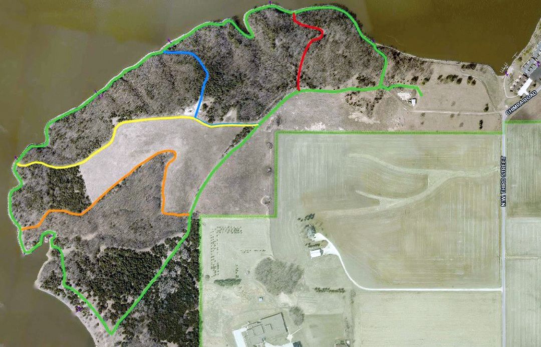
According to Rumelhart, the LPA and DNR have teamed up to develop specific hunting zones at the lake. The zones are changed periodically based on deer population changes, so Rumelhart encourages interested hunters to log onto the LPA website and then check in the Hunting folder for the current map of approved deer hunting zones.
“You have to be a member to sign up, or a guest of a member. It’s free for members but costs $50 for guests to register, and you have to sign up under a member who is registered to hunt,” Rumelhart said. Each member can have up to three non-member guests sign up under the member’s name.
“We typically get around 100 members signed up every year, and they shoot anywhere from 120 to 150 deer, so that program continues to be really successful for us,” he said. “We’d like to harvest over 100 each year. That number doesn’t seem to fluctuate much, and we’re really happy with it.”
Rumelhart notes that residing at Lake Panorama doesn’t offer any special permission. Hunters are still required to have a tag to hunt a deer and must be within one of the designated hunting zones. Deer tags can be obtained from any approved vendor in the state, including the LPA office.
Iowa has a variety of deer hunting seasons. For the 2023-2024 season, these include: Youth, Sept. 16 - Oct. 1
Disabled Hunter, Sept. 16 - Oct. 1
Archery, Oct. 1 - Dec. 1 AND Dec. 18 - Jan. 10
Muzzleloader Early: Oct. 14-22, Late: Dec. 18 - Jan. 10
Shotgun First: Dec. 2-6, Second: Dec. 9-17
Nonresident Holiday Dec. 24 - Jan. 2
Population Management, January Antlerless, Jan. 11-21
Excess Tag January Antlerless, Jan. 11-21.
Shooting hours for all deer seasons are one half-hour before sunrise to one half-hour after sunset.
Dealing with dead deer
Rumelhart says he receives questions at times about how to deal with a dead deer on an LPA member’s property.
“If a deer dies on your property, then you need to call one of our Animal Nuisance control specialists,” he said. “We have those listed on our vendor list. Those folks can remove that animal for a fee.”
Rumelhart says, if feasible, the property owner can drag the deer to the nearest edge of the timber and let nature take its course.
“There are a lot of animals and critters around here that will take care of a dead deer rather quickly,” he said. “Some folks may find that a bit gruesome, but that’s just nature, and that’s where we live.”
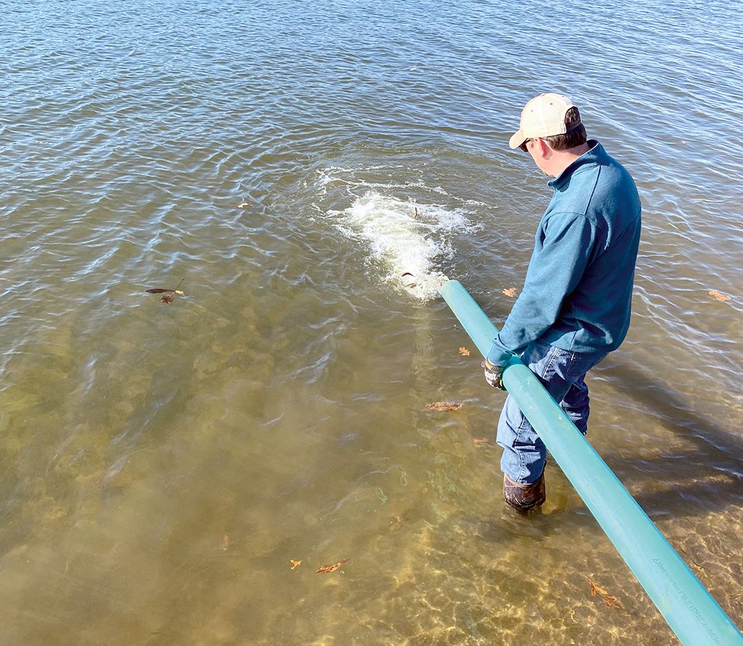
And if a deer is seen in the water?
“If there’s a deer in the lake, just call the office, and either security or maintenance will go out and try to get that deer out of the lake with our barge equipment.”
Rumelhart said if a sick or wounded animal is seen to always call the DNR.
“They’re legally responsible for taking care of those animals,” he said.
Deer population trends at the lake
According to DNR officer King, the trends in the deer population at Lake Panorama are difficult to determine.
“People can drive around and see more deer than they did last year and assume the deer population is up. And, at the same time, another person might not see many deer and assume the population is down,” he said. “Really, the basis the DNR uses is harvest registrations. Anytime a hunter harvests a deer, they’re required by law to report the harvest by midnight the day after they kill it. Then we can look at that data and see what our harvest trend is like, and we can compare that to our hunter numbers as well.”
King said he worked with the DNR wildlife department and the LPA two years ago, and they came up with the deer management zone around the lake so that they were allotted their own number of tags.
“Prior to that, anytime a member of Lake Panorama wanted to hunt Lake Panorama ground, they bought antlerless tags, and those would come out of the countywide quota,” he said. “Two years ago, we established a quota just for Lake Panorama.”
Taking all factors into consideration, King feels the deer population around Lake Panorama is relatively steady. In determining what is a “proper” number of deer, King stressed that it depends on the observer. He said, for some citizens, even a few deer are too many, while for hunters, there may never be enough.
“Trying to find that social balance is a really difficult thing,” he said.
Nuisance deer
King said that, if a deer is eating your plants, you are not allowed to shoot it.
“There are processes to try to reduce or eliminate deer damage to property,” he said. “We have a deer biologist who specifically focuses on how to help landowners and homeowners deal with nuisance deer problems.”
King lives at Lake Panorama, and he is familiar with the many interactions with deer that happen regularly here.
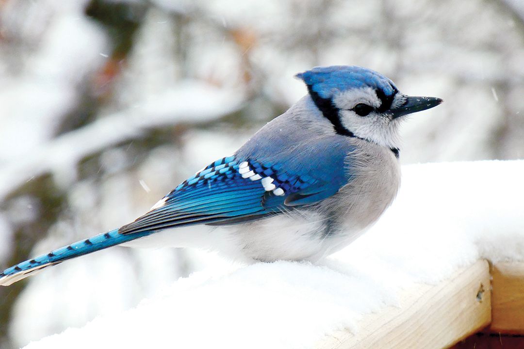
“They like bird feeders,” King said, “They like going where there’s an easy meal. They are animals of survival. If people are having issues with deer around their house, maybe remove those bird feeders or elevate them high enough where deer can’t get to them.”
He added that deer will sometimes stand on their back legs to reach food, so they can reach as high as 8 feet. Other suggestions for preventing deer damage to plants and trees include putting a wrap or chicken wire around trees and installing a high fence around gardens. Also, some plants are known to emit scents that deer don’t like to approach. These include lavender, sage, yarrow, daffodil and marigold.
“Another simple thing you can do that usually works pretty well is add a dryer sheet with a paper clip or something attached to the plant or the area,” King said. “A lot of times, that will ward them off.”
King stresses that deer are quickly getting used to being around people.
“I’ve driven around Lake Panorama and seen deer literally lying against houses underneath the dryer vent where the warm air is blowing on them in the winter,” he said. “A number of animals have learned to become very adapted to humans. Whitetail deer is one of them, along with raccoons and Canada geese. Deer have just learned to live with humans.”
In addition to dealing with live deer, King acknowledges, as Rumelhart did, that occasionally a deer carcass needs to be removed. He said the standard practice for dealing with dead deer on a roadway is to drag it into the nearest ditch.
“If a landowner finds one, absolutely, they’re more than welcome to drag it off somewhere,” he said. “If you find a dead deer and you want the antlers, the way Iowa’s laws are, if the antlers are still attached to the skull, then you have to get a salvage tag before you can take them.”
King said the salvage tag is free and can be obtained through him by calling or texting his work cell phone number of 712-250-0061.
Deer and disease
King says Chronic Wasting Disease (CWD) in Guthrie County has not been a problem.
“There are about seven to nine counties in Iowa that have it,” he said. “The nearest one is Greene County, where one deer has been sampled in the last two years that had CWD. This issue that we have is EHD, which is also known as ‘blue tongue.’ ”
EHD, which stands for Epizootic Hemorrhagic Disease, is common in the county’s deer.
“It’s a disease the deer get by being bitten by a midge bug,” he said. “It basically causes their tongue to swell, and they run a fever, so they go to water. And usually within three to four days after they’ve been bitten, they die.”
Deer infected with the EHD virus will often be found dead in the water. King said over the past year, three deer carcasses were found at Lake Panorama from suspected EHD virus. He asks the public to inform him of any such carcasses so the DNR can use accurate data to help adjust hunting tag numbers to best balance the population.
Enjoy the deer
In summarizing how to deal with wildlife nuisance issues, King said, “We do have a federal biologist that we work with, and our local biologist can help you come up with solutions if you have a major issue going on. And I think a lot of folks need to remember that we have a beautiful lake…and we’re going to have wildlife that’s going to be around there. We built homes in their home.”
King encourages everyone to remember that the natural beauty of the lake area includes geese, deer, raccoons, foxes, mink, bobcats and other animals. His best advice?
“Pour an extra cup of coffee, sit back and enjoy it.”
By Rich Wicks
Lake Panorama Times
“Watch out for deer” is common advice in Iowa, often said both as a cautionary reminder to drive carefully and as a way of indicating, “I care about you.” As more roads and homes are built, encounters with deer are inevitable. But it wasn’t always this way.
Iowa’s history with deer
When settlers were first arriving in the territory that would eventually become Iowa, deer were plentiful, according to data shown on the Iowa DNR website. But throughout the 1800s, the deer population was hunted extensively, and the population plummeted. In 1898, the 27th General Assembly provided complete protection for deer by closing the hunting season year-round. By this time, deer were nearly extinct in most areas of the state.
Deer were re-established in Iowa through the escape of animals from captive herds, trapping and transplanting programs of the Iowa Department of Natural Resources, and the immigration of animals from neighboring states. In 1894, 35 whitetails escaped from a captive herd in Avoca, which provided the nucleus for future herds in western Iowa. In the early 1920s, about 60 deer escaped from a farm in Washington County and became established along the Skunk River. Another herd was established in Boone County at Ledges State Park in 1928 when two deer, purchased from Minnesota, were released. In 1947, the first statewide population estimate was made with deer herds reported in 58 counties containing an estimated 1,650 animals. Deer herds were reported in 89 counties in 1950, and the population estimate was expanded to 13,000. In 2020, the statewide estimate was 445,000.
Hunting as a solution to deer overpopulation
The rapid rise of Iowa’s deer population has led to concerns of crop damage when deer feed on corn, soybeans or other crops. Deer also cause damage in gardens and yards. Because of the swelling population and lack of natural predators, hunting is considered the best means to control the population. Without adequate hunting, the number would be balanced only through disease, starvation and roadkill incidents.
Local DNR officer Jeremy King pointed out that, although some people oppose hunting, animals harvested through hunting generally do not suffer long, whereas some of the natural diseases that arise in overpopulated herds lead to animals undergoing a long, painful death. The latest statewide harvest data shows that, for the 2019-2020 season, hunters harvested 109,544 deer in Iowa.
The whitetail deer situation at Lake Panorama mirrors the statewide status. Lane Rumelhart, project manager for the Lake Panorama Association, provided information on efforts to control the local deer population and minimize related problems.
“We have a hunting program for controlling the population, and we strongly recommend our members do not feed the deer,” Rumelhart said. “Obviously, feeding the deer is going to attract them to your house, and they’re going to stay in that general area more frequently, and you’re going to anger your neighbors. It’s best to just let the deer roam freely and find their food on their own.”
Rumelhart also discourages residents from putting out salt or mineral blocks for the same reason.
According to Rumelhart, the LPA and DNR have teamed up to develop specific hunting zones at the lake. The zones are changed periodically based on deer population changes, so Rumelhart encourages interested hunters to log onto the LPA website and then check in the Hunting folder for the current map of approved deer hunting zones.
“You have to be a member to sign up, or a guest of a member. It’s free for members but costs $50 for guests to register, and you have to sign up under a member who is registered to hunt,” Rumelhart said. Each member can have up to three non-member guests sign up under the member’s name.
“We typically get around 100 members signed up every year, and they shoot anywhere from 120 to 150 deer, so that program continues to be really successful for us,” he said. “We’d like to harvest over 100 each year. That number doesn’t seem to fluctuate much, and we’re really happy with it.”
Rumelhart notes that residing at Lake Panorama doesn’t offer any special permission. Hunters are still required to have a tag to hunt a deer and must be within one of the designated hunting zones. Deer tags can be obtained from any approved vendor in the state, including the LPA office.
Iowa has a variety of deer hunting seasons. For the 2023-2024 season, these include: Youth, Sept. 16 - Oct. 1
Disabled Hunter, Sept. 16 - Oct. 1
Archery, Oct. 1 - Dec. 1 AND Dec. 18 - Jan. 10
Muzzleloader Early: Oct. 14-22, Late: Dec. 18 - Jan. 10
Shotgun First: Dec. 2-6, Second: Dec. 9-17
Nonresident Holiday Dec. 24 - Jan. 2
Population Management, January Antlerless, Jan. 11-21
Excess Tag January Antlerless, Jan. 11-21.
Shooting hours for all deer seasons are one half-hour before sunrise to one half-hour after sunset.
Dealing with dead deer
Rumelhart says he receives questions at times about how to deal with a dead deer on an LPA member’s property.
“If a deer dies on your property, then you need to call one of our Animal Nuisance control specialists,” he said. “We have those listed on our vendor list. Those folks can remove that animal for a fee.”
Rumelhart says, if feasible, the property owner can drag the deer to the nearest edge of the timber and let nature take its course.
“There are a lot of animals and critters around here that will take care of a dead deer rather quickly,” he said. “Some folks may find that a bit gruesome, but that’s just nature, and that’s where we live.”
And if a deer is seen in the water?
“If there’s a deer in the lake, just call the office, and either security or maintenance will go out and try to get that deer out of the lake with our barge equipment.”
Rumelhart said if a sick or wounded animal is seen to always call the DNR.
“They’re legally responsible for taking care of those animals,” he said.
Deer population trends at the lake
According to DNR officer King, the trends in the deer population at Lake Panorama are difficult to determine.
“People can drive around and see more deer than they did last year and assume the deer population is up. And, at the same time, another person might not see many deer and assume the population is down,” he said. “Really, the basis the DNR uses is harvest registrations. Anytime a hunter harvests a deer, they’re required by law to report the harvest by midnight the day after they kill it. Then we can look at that data and see what our harvest trend is like, and we can compare that to our hunter numbers as well.”
King said he worked with the DNR wildlife department and the LPA two years ago, and they came up with the deer management zone around the lake so that they were allotted their own number of tags.
“Prior to that, anytime a member of Lake Panorama wanted to hunt Lake Panorama ground, they bought antlerless tags, and those would come out of the countywide quota,” he said. “Two years ago, we established a quota just for Lake Panorama.”
Taking all factors into consideration, King feels the deer population around Lake Panorama is relatively steady. In determining what is a “proper” number of deer, King stressed that it depends on the observer. He said, for some citizens, even a few deer are too many, while for hunters, there may never be enough.
“Trying to find that social balance is a really difficult thing,” he said.
Nuisance deer
King said that, if a deer is eating your plants, you are not allowed to shoot it.
“There are processes to try to reduce or eliminate deer damage to property,” he said. “We have a deer biologist who specifically focuses on how to help landowners and homeowners deal with nuisance deer problems.”
King lives at Lake Panorama, and he is familiar with the many interactions with deer that happen regularly here.
“They like bird feeders,” King said, “They like going where there’s an easy meal. They are animals of survival. If people are having issues with deer around their house, maybe remove those bird feeders or elevate them high enough where deer can’t get to them.”
He added that deer will sometimes stand on their back legs to reach food, so they can reach as high as 8 feet. Other suggestions for preventing deer damage to plants and trees include putting a wrap or chicken wire around trees and installing a high fence around gardens. Also, some plants are known to emit scents that deer don’t like to approach. These include lavender, sage, yarrow, daffodil and marigold.
“Another simple thing you can do that usually works pretty well is add a dryer sheet with a paper clip or something attached to the plant or the area,” King said. “A lot of times, that will ward them off.”
King stresses that deer are quickly getting used to being around people.
“I’ve driven around Lake Panorama and seen deer literally lying against houses underneath the dryer vent where the warm air is blowing on them in the winter,” he said. “A number of animals have learned to become very adapted to humans. Whitetail deer is one of them, along with raccoons and Canada geese. Deer have just learned to live with humans.”
In addition to dealing with live deer, King acknowledges, as Rumelhart did, that occasionally a deer carcass needs to be removed. He said the standard practice for dealing with dead deer on a roadway is to drag it into the nearest ditch.
“If a landowner finds one, absolutely, they’re more than welcome to drag it off somewhere,” he said. “If you find a dead deer and you want the antlers, the way Iowa’s laws are, if the antlers are still attached to the skull, then you have to get a salvage tag before you can take them.”
King said the salvage tag is free and can be obtained through him by calling or texting his work cell phone number of 712-250-0061.
Deer and disease
King says Chronic Wasting Disease (CWD) in Guthrie County has not been a problem.
“There are about seven to nine counties in Iowa that have it,” he said. “The nearest one is Greene County, where one deer has been sampled in the last two years that had CWD. This issue that we have is EHD, which is also known as ‘blue tongue.’ ”
EHD, which stands for Epizootic Hemorrhagic Disease, is common in the county’s deer.
“It’s a disease the deer get by being bitten by a midge bug,” he said. “It basically causes their tongue to swell, and they run a fever, so they go to water. And usually within three to four days after they’ve been bitten, they die.”
Deer infected with the EHD virus will often be found dead in the water. King said over the past year, three deer carcasses were found at Lake Panorama from suspected EHD virus. He asks the public to inform him of any such carcasses so the DNR can use accurate data to help adjust hunting tag numbers to best balance the population.
Enjoy the deer
In summarizing how to deal with wildlife nuisance issues, King said, “We do have a federal biologist that we work with, and our local biologist can help you come up with solutions if you have a major issue going on. And I think a lot of folks need to remember that we have a beautiful lake…and we’re going to have wildlife that’s going to be around there. We built homes in their home.”
King encourages everyone to remember that the natural beauty of the lake area includes geese, deer, raccoons, foxes, mink, bobcats and other animals. His best advice?
“Pour an extra cup of coffee, sit back and enjoy it.”